Sheffield weather: This is how long thunderstorms will last in Sheffield as Met Office updates weather warning
and live on Freeview channel 276
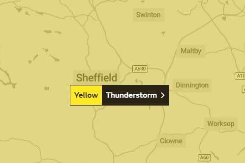
The Met Office has issued a yellow weather warning for thunderstorms today – Thursday, September 9 – with temperatures also set to cool off slightly compared to the sweltering conditions in recent days.
The turn of events could be the start of a very “unsettled” September, with much more rain, wind and possible stormy weather on the way.


Advertisement
Hide AdAdvertisement
Hide AdHere is everything you need to know about this week’s thunderstorms and how long they will last.
How long will the thunderstorms last?
Earlier this week the Met Office issued a yellow weather warning for thunderstorms in Sheffield for Thursday, September 9 and this was originally set to be in place from 11am to 8pm.
However the forecaster has now updated the warning and it will now be in place from 10am.
Although the weather warning for thunderstorms will be in force throughout the day, the hour-by-hour forecast from the Met Office has not given the exact times of the storms.
Advertisement
Hide AdAdvertisement
Hide AdThe weather warning does end on Thursday night though, and although there is set to be more rain this week, more storms are currently unlikely after tomorrow.
What to expect from thunderstorms
The Met Office has warned people to expect heavy showers and thunderstorms, with the possibility of surface water flooding in a few places, and disruption to travel.
It says there is a small chance that homes and businesses could be flooded quickly, with damage to some buildings from floodwater, lightning strikes, hail or strong winds.
The expected downpours could cause delays and some cancellations to train and bus services, and lead to treacherous driving conditions.
What is the current forecast for Thursday?
Advertisement
Hide AdAdvertisement
Hide AdThere has been an update to the timings that rain is expected tomorrow, and a change in how heavy the winds will be, since the original warning was issued yesterday.
Rain is now expected for most of the afternoon, from 3pm to 8pm, with a 40 per cent chance of showers. The morning is looking relatively bright, with sunny spells and a 10 per cent chance of rain – unlike the heavy rain that the Met Office previously forecast. A high of 23C is forecast in the afternoon and 19C in the evening.
Despite the thunderstorm warning, wind speeds are now forecast to remain relatively low with gusts reaching 14mph at their peak.
What is the weather forecast for the rest of the week?
On Friday, it is expected to be cloudy in the morning, changing to light showers by the afternoon. There is a 40 per cent chance of rain between 4pm and 7pm. Highs of 21C are forecast for the afternoon, and 17C in the evening.
Advertisement
Hide AdAdvertisement
Hide AdOn Saturday the Met Office is predicting there will be sunny spells through much of the day, with highs of 21C in the afternoon and 16C in the evening. There is currently between a 5 and 10 per cent chance of rain through the day.
Sunday is set to be cloudy, with highs of 18C during the day and 14C in the evening.