
Sheffield weather: What is the chance of snow this weekend and how cold is it going to get?

Sheffield is in for a flurry of snow and days of biting cold temperatures this weekend - but how bad will it get?
2025 has got off to a bitter start with the arrival a cold snap across much of England.
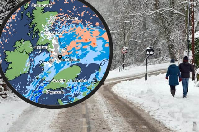

In fact, the UK Health Security Agency (UKHSA) has now issued a rare amber ‘Cold-Health Alert’ for all parts of England until midday on Wednesday, January 8.
It means the cold weather is likely to have an impact on the whole of the NHS and health services “for an extended period of time,” and there is a risk of harm to vulnerable people, the elderly and people with pre-existing health conditions.
Meanwhile, together with plunging temperatures, a yellow weather warning for snow in Sheffield and nearly the whole country is in place for three whole days starting at midday on Saturday and lasting until 6am on Monday.
Dr Agostinho Sousa, Head of Extreme Events and Health Protection at UKHSA, said: “It is therefore vital to check in on friends, family and neighbours that are most vulnerable. These people could be more at risk of heart attacks, stroke and chest infections as a result of cold temperatures.”
Here is the latest weather forecast for Sheffield for the weekend ahead.
Weather forecast for Sheffield January 3 - 8 during amber health Cold-Health Alert
In Sheffield, the Met Office has increased the likelihood the Steel City will see snow on Sunday morning (January 5).
In fact, it is now expected to start snowing from early Saturday evening.
However, it is still unclear how likely it is to settle, as heavy rain is also predicted in parts on Sunday.
And although the air temperature will typically stay above freezing and hover around 2-3C each day, it will often “feel like” -1C or as low as -4C, according to the Met Office.
Friday, January 3 - Very cold start but warming up to 4C in the late afternoon. Scattered light rain expected all day until 4pm. Temperatures dropping to 1C again overnight.
Saturday, January 4 - A yellow weather warning for snow is in place for nearly all of England starting on Saturday and lasting until Monday. In Sheffield, clouded sunshine with low temperatures of around 2C. Chances of snow arriving from 9pm are increasing rapidly, possibly accompanied by rain.
Sunday, January 5 - The worst of it. Freezing temperatures overnight that will ‘feel like’ -4C. A forecast of snow overnight into Sunday morning has been upgraded to a good chance of snow until noon, accompanied by freezing rain in the morning and a ‘95 per cent’ coverage of heavy rain by the afternoon. Unclear if any snow is expected to settle. Rain likely to be heaviest at noon. However, getting warmer overnight, with temperatures expected to rise to 4C by the evening, the warmest in days.
Monday, January 6 - Very chaotic. Rain overnight followed by spells of clouded sunshine and rain, with winds picking up to 35mph. Maximum temperature 3C.
Tuesday & Wednesday, January 7-8 - Very cold. 0C expected both mornings but warming up to 5C by Wednesday afternoon. Good chance of scattered showers both days.
The yellow weather warning over the weekend brings a chance of longer journey times and cancellations for those travelling by road, rail, air and ferry, according to the Met Office.
Sub-zero temperatures on most nights increases the chance of icy patches and frost to start most mornings in the next few days as well.