
Sheffield snow: Three-day yellow weather warning for weekend snow as 2025 starts with cold snap

2025 is off to a bitterly-cold start in the UK with freezing temperatures and a good chance of snow this weekend.
Sheffield residents are being welcomed to their new year today (January 2) with Baltic 0C temperatures outside.
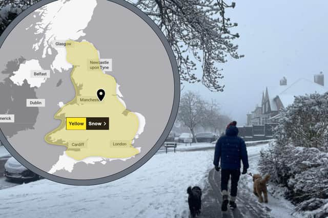

Now, forecasters say it’s sadly going to stay that way all through the weekend.
A yellow weather warning for snow in Sheffield and nearly all of England is in place for three whole days starting at midday on Saturday and lasting until 6am on Monday.
In Sheffield, the Met Office predicts the Steel City will most likely see snow on Sunday morning between 6am and midday.
It is unlikely to settle though, as it is expected to be followed by rain come the afternoon.
Here is your weather forecast for Sheffield for this bitterly cold first week of January 2025.
Thursday, January 2 - Risk of icy patches this morning due to 0C temperatures overnight. Bright but temperatures hovering around 1C all day and dropping below freezing by night.
Friday, January 3 - Very cold start but warming up to 3C in the late afternoon. Cloudier with a chance of light rain between 6am and midday.
Saturday, January 4 - A weather warning for snow is in place for nearly all of England starting on Saturday and lasting until Monday. Chance of brief scattered snow and showers all day in Sheffield, with greatest chance of heavy snow at 9am. Maximum temperatures of 2C.
Sunday, January 5 - Snow overnight into Sunday morning very likely, but it is not expected to settle, as heavy showers expected by midday. Rain likely to be heaviest at noon. Getting warmer overnight, with temperatures expected to rise to 4C by evening.
Monday, January 6 - Rain expected to continue all day until 3pm. Wing picking up to 35mph.
Dan Holley is a Deputy Chief Forecaster for the Met Office. He said: “At this stage there is a fair amount of uncertainty over exactly which areas will see disruptive snow, with parts of Wales, northern England and the Midlands most likely to see some impacts.
“Here we could see 5cm or more in quite a few areas, and perhaps as much as 20-30cm over high ground, including Wales and the Pennines. Coupled with strengthening winds this could lead to drifting, making travelling conditions difficult over higher-level routes in particular.
“We’ve currently issued a Yellow warning for snow covering a large part of England, Wales and southern Scotland to cater for possible disruption over the weekend, but it’s quite likely this will be refined over the coming days as confidence in the forecast increases. So it’s worth keeping up to date with the latest warnings.”
The yellow weather warning over the weekend brings a chance of longer journey times and cancellations for those travelling by road, rail, air and ferry, according to the Met Office.
Sub-zero temperatures on most nights increases the chance of icy patches and frost to start most mornings in the next few days as well.