Sheffield weather: Met Office issues update on when snow is most likely for city

and live on Freeview channel 276
The forecaster has now released its predictions for the city up to Sunday, February 20.
While settled conditions look set to dominate the rest of January, things could change as we head into the start of February.


Advertisement
Hide AdAdvertisement
Hide AdAfter weeks of dry and bright conditions with limited rain, the trend could turn towards rain, gales and cloud.
However, apart from the occasional frost, milder temperatures could remain in place in Sheffield for quite some time.
Met Office long range weather forecast Sheffield
The next few days in Sheffield will see generally settled conditions, with little chance of rain and above average temperatures.
Some frost and fog are expected on odd occasions, especially in the mornings.
Advertisement
Hide AdAdvertisement
Hide AdA strong breeze is likely to develop mid-week, although conditions are likely to get sunnier and brighter as the week goes on.
As we move forwards to January 27, some rain is expected, with a risk of gales.
These are likely to be shortlived however as the rest of the period towards February 1 will see settled and mild conditions.
After this, the beginning of February is expected to bring ‘an increasing likelihood of more unsettled conditions’, with occasional showers and strong winds.
Advertisement
Hide AdAdvertisement
Hide AdThis weather trend is likely to continue throughout the month, with wet and windy conditions on the way, along with slightly above average temperatures for the time of year.
But the Met Office does say that some ‘short-lived’ colder spells could be on the way for the region in February, bringing periods of frost and ice as we head into the middle of the month.
When will it snow in Sheffield?
According to the latest Met Office update, some snow could be likely in Yorkshire before the middle of February, as some colder spells could be on the way for the region.
However, these are not expected to last long and the Met Office says if there is any snow, this is expected to fall over hills and higher ground.
Advertisement
Hide AdAdvertisement
Hide AdIt is unlikely at this time that we will see much snow falling in the inner city or valleys, although there is a chance that some will fall on higher areas of Sheffield and its surroundings.
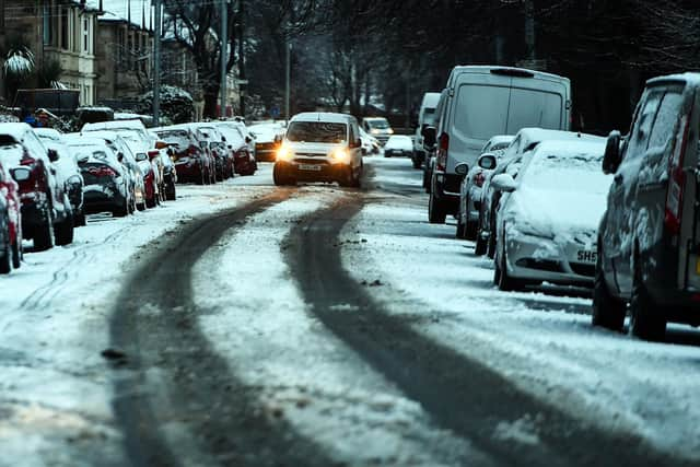
The beginning of January saw a blanket of snow covering Sheffield, with higher areas like Crosspool and Crookes getting the heaviest snowfall.
The end of 2021 also saw a number of instances of heavy snow falling over the city, particularly at the end of November when Storm Arwen brought arctic conditions and gale force winds to the north.
The storm brought traffic chaos, disruptions to bus and train services and dangerous conditions on the city’s roads.
Advertisement
Hide AdAdvertisement
Hide AdSome areas like Parson Cross, Darnall and Fox Valley were also hit by power outages, leaving residents freezing at home and forcing shops to delay their opening.
Northern Powergrid said the storm was having ‘significant impact and causing extensive damage’ to their overhead power network.