Sheffield weather: Hour by hour forecast as Storm Barra brings Met Office weather warning for city on Tuesday

and live on Freeview channel 276
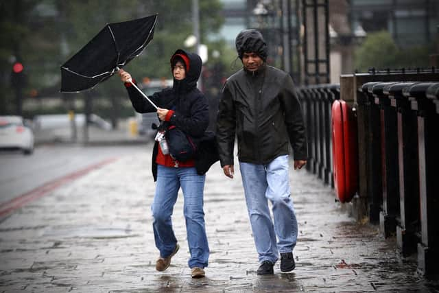
Following the chaos brought about by Storm Arwen at the end of last month, Sheffielders are being warned that more disruption could be on the way as a second storm arrives this week.
Storm Barra is likely to bring strong winds and rain to Sheffield, although Ireland is expected to take the brunt of the bad weather.
Advertisement
Hide AdAdvertisement
Hide AdThe Met Office has issued a series of National Severe Weather Warnings and these will be in force across much of the UK.


The forecaster has also said the storm could bring some snow to the north of England, with ‘two to five cm of snow’ expected on hills and higher ground.
Although snow is not officially forecast for Sheffield, depending on how severe the storm hits, winds of up to 40mph are on the cards and heavy rain is expected all day on Tuesday, December 7.
Here is everything you need to know.
When will Storm Barra hit Sheffield?
The Met Office has put a yellow weather warning for wind in place for the city from 9am to 11.59pm on Tuesday, December 7.
Advertisement
Hide AdAdvertisement
Hide AdIt is part of a series of national weather warnings which are being enforced across the UK.
Storm Barra is expected to hit coastal areas in the morning, before moving inland in the afternoon.
According to its latest forecast, the conditions in Sheffield are expected to be at their worst between 2pm and 6pm, when heavy rain and very high winds are most likely.
The Met Office says the winds could cause some disruption to travel, including the possibility of delays to bus and rail services.
Advertisement
Hide AdAdvertisement
Hide AdIt also says ‘some damage to trees’ is possible, and that there may be ‘some short term’ loss of power.
Hour by hour weather forecast Sheffield
Here is the hourly forecast for Sheffield on Tuesday, December 7, when a yellow weather warning for wind is in place and Storm Barra is expected.
7am: Cloudy, less than 5 per cent chance of rain, 1C, winds of 13mph
8am: Cloudy, 10 per cent chance of rain, 1C, winds of 16mph
9am: Cloudy, less than 5 per cent chance of rain, 1C, winds of 18mph (weather warning comes into force)
Advertisement
Hide AdAdvertisement
Hide Ad10am: Cloudy, 10 per cent chance of rain, 1C, winds of 19mph
11am: Cloudy, 20 per cent chance of rain, 2C, winds of 21mph
12pm: Overcast, 30 per cent chance of rain, 3C, winds of 26mph
1pm: 60 per cent chance of light rain, 3C, winds of 31mph
2pm: More than 95 per cent chance of heavy rain, 3C, winds of 36mph
Advertisement
Hide AdAdvertisement
Hide Ad3pm: More than 95 per cent chance of heavy rain, 3C, winds of 39mph
4pm: More than 95 per cent chance of heavy rain, 4C, winds of 39mph
5pm: 90 per cent chance of heavy rain, 5C, winds of 37mph
6pm: 80 per cent chance of heavy rain, 5C, winds of 31mph
7pm: 30 per cent chance of light rain, 5C, winds of 29mph
8pm: Less than 5 per cent chance of rain, 5C, winds of 30mph
9pm: Less than 5 per cent chance of rain, 5C, winds of 30mph
10pm: 10 per cent chance of rain, 4C, winds of 31mph
11pm: 10 per cent chance of rain, 4C, winds of 33mph
Why is it named Storm Barra?
Advertisement
Hide AdAdvertisement
Hide AdAccording to the Met Office, Storm Barra - the second named storm of the season - is a name selected as part of the Name Our Storms collaboration with Irish forecasters Met Éireann and Dutch forecasters KNMI.
Frank Saunders, chief meteorologist at the Met Office, said: “Strong winds arriving across the west through Tuesday morning, will spread inland and reach eastern areas through the afternoon and early evening. Gusts of 45-50 mph are expected widely, with 60-70 mph in exposed coastal locations. The strongest winds will ease across inland areas into the overnight period.”
Deputy chief meteorologist, Brent Walker, added: “A band of rain will turn to snow across northern England and Scotland through Tuesday. Two to five cm of snow is expected to accumulate quite widely across the warning area, but locally this could reach ten cm, particularly in parts of the Southern Uplands and Highlands.
“Strong south-easterly winds will also lead to snow drifting in places, particularly over the highest routes, adding to poor visibilities.”