
Most deprived areas of Sheffield and Rotherham revealed including part of Fir Vale

New data shows which parts of the country are the most deprived, with an area in Rotherham one of the top 10.
The Ministry for Housing, Communities and Local Government (MHCLG) has published new deprivation data showing the areas in the UK suffering from the highest rates of unemployment and where income, lifespan and crime are at their worst.
Figures are used to compile The Indices of Deprivation (IoD25), a ranking which helps compare and contrast the struggles of neighbourhoods and local authorities in England.
The MHCLG clarifies that while this can be used to ‘identify the most deprived small areas’, they do not suggest that every one living in an area is struggling, or that those in less deprived areas are wealthy.
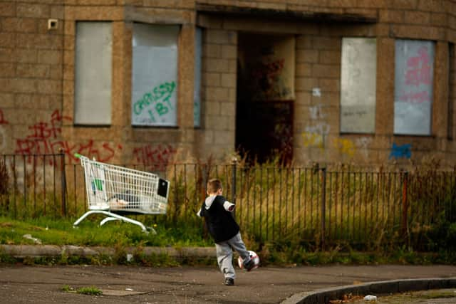

While terms like ‘most deprived’ and ‘hardest hit’ will be used to breakdown the data, The Star notes that these experiences are not indicative of everyone in an area.
Detailing their research, The MHCLG wrote: “Across England, the patterns of deprivation are complex. The most and least deprived neighbourhoods are spread throughout the country. “
The last report of this kind was released in 2019, with others compiled from Wales, Scotland and Northern Ireland respectively.
An area in Tendring - around Clacton, Essex - was ranked as most deprived, while seven areas in Blackpool and one in Hastings made the top ten.
One part of Rotherham came in tenth, out of all 33,755 neighbourhoods measured nationally.
In the MHCLG’s rankings, areas aren’t neatly defined by district or postcode, instead being loosely defined areas.
As such, the most deprived area of Rotherham is surrounding Hartley Road, near to Clifton Park, while Rotherham as a whole is the 53rd most deprived local authority in England.
Sarah Champion, Rotherham MP, said: “I hate that parts of Rotherham are in the top 10 most deprived areas. These are good people trying to keep afloat in the most challenging circumstances, usually not of their making.
“From the global economic crash, to austerity and the cost of living crisis, people had the odds stacked against them. Those with the least seemed to take the brunt of successive government cuts. I am optimistic things will start to change for the better, but, realistically, that is going to take time - something people with bills to pay today don’t have.
“All I can say as the MP is; I will continue to advocate for the people of Rotherham and push for improvements across the board as tackling deprivation does not have a single solution.”
It matches wider data trends reported by the MHCLG, which identifies former areas of industry and mining - as much of South Yorkshire was in previous centuries - as the hardest hit.
A statement explains: “As was the case in previous versions of the indices, the IoD25, reveals concentrations of deprivation in large urban conurbations (such as Birmingham, Liverpool, Greater Manchester and parts of Teesside), areas that have historically had large heavy industry manufacturing and/or mining sectors (such as Bradford, Nottingham, Blackburn with Darwin), coastal towns (such as Blackpool, Hartlepool and Hastings) and parts of east London.”
Another area of Rotherham, surrounding Ferham Primary School, was ranked the 15th most deprived area, while places around Grimesthorpe were seen as the most deprived in Sheffield.
Notably, an area around Fir Vale school, stretching from Owler Lane down to the River Don, was ranked the 22nd most deprived in England, making it the most deprived in the city.
We’ve compiled a list of the top 10 most deprived areas in Sheffield, using post codes and streets to identify:
- S4 - S9: Fir Vale, Owler Lane - Attercliffe Common; Ranked 22nd nationally
- S13: Woodhouse, Chapel Street - Shire Brook Valley; Ranked 73rd nationally
- S5: Firth Park, Firth Park Road - Cammell Road: Ranked 77th nationally
- S4: Fir Vale, Firth Park Road - Wensley Street; Ranked 104th nationally
- S5: Longley Park, Longley Lane - Northern General Hospital; Ranked 178th nationally
- S2 - S14: Gleadless, Gleadless Road - Gleadless Valley; Ranked 245th nationally
- S2: Gleadless, Eastern Avenue - Hurlfield Road; Ranked 256th nationally
- S5: Wadsley Bridge, Dryden Road - Herries Roa: Ranked 268th nationally
- S8: Batemoor, Lowedges Crescent - Dyke Lane; Ranked 297th nationally
- S2: Gleadless, Algar Road - Hurlfield Road; Ranked 354th nationally
MPs Gill Furniss has been approached for comment, with Fir Vale forming part of her constituency.