Sheffield weather: Wind gusts of more than 50mph, heavy rain and snow forecast for city as Storm Dudley hits

and live on Freeview channel 276
Weather warnings have been put in place across the country as dangerous conditions are forecast.

In Scotland, a ‘danger to life’ warning has been issued, with wind speeds of up to 90mph are expected to batter the country’s coasts.

Advertisement
Hide AdAdvertisement
Hide AdResidents have been told to prepare for damage to buildings and falling trees in the wake of the storm.
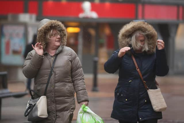
In Sheffield and South Yorkshire, winds of more than 50mph are on the cards, as well as heavy rain and even the potential of snow.
The Met Office said: “Storm Dudley is expected to affect the UK on Wednesday night and Thursday, bringing a period of very strong and disruptive winds.”
On Friday, Storm Eunice is predicted to cause further disruption, with more windy and wet conditions on the way.
Advertisement
Hide AdAdvertisement
Hide AdBut how exactly will the storms affect Sheffield and what is the forecast for the week?
How will Storm Dudley and Storm Eunice affect Sheffield?
Although there are currently no weather warnings in place for Sheffield on Wednesday or Thursday when Storm Dudley hits, a yellow weather warning for wind is in place on Friday.
Despite this, gales of up to 50mph are forecast for the city on Wednesday and 54mph winds are expected on Thursday.
On Friday, the Met Office says heavy rain, sleet and even some snow could be on the cards as Storm Eunice moves in.
Advertisement
Hide AdAdvertisement
Hide AdThe yellow weather warning, which is in force from midnight to 9pm on Friday, says there is a risk of damage to buildings, trees and power lines when the storm hits.
There is also a small chance that roads, bridges and railway lines could close and there could be significant disruption and delays to travel.
‘Signifcant snowfall’ could also occur over hills and higher ground.
Met Office Chief Meteorologist, Paul Gundersen, said; “An active jet stream is driving low-pressure systems across the country, both of which are likely to cause some disruption and National Severe Weather Warnings have been issued."
Weather forecast Sheffield
Advertisement
Hide AdAdvertisement
Hide AdAfter a rainy start on Tuesday, sunny spells are expected for Sheffield, before clouds move in for the afternoon. Winds will begin to pick up to highs of 35mph and highs of 8C are forecast.
Wednesday will see a 90 per cent chance of heavy rain in the afternoon and winds picking up to 50mph for the evening as Storm Dudley hits. Highs of 12C.
On Thursday, the rain is expected to clear, with sunny spells all day, and highs of 7C. Winds will be severe in the morning – up to 54mph – before easing in the evening.
Storm Eunice will sweep in on Friday, bringing with it a yellow weather warning. Sleet is expected in the early morning, before turning to heavy rain. Highs of 5C are forecast, as are wind speeds of up to 41mph.
In its long range forecast, the Met Office says conditions will remain ‘changeable’ into next week.