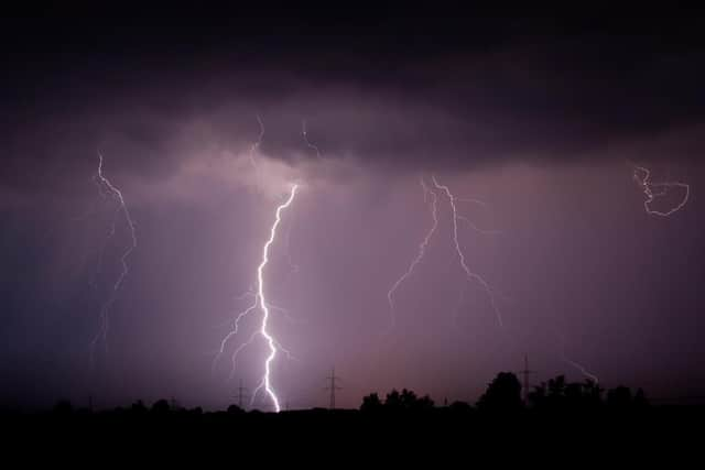
Sheffield weather: This is when the Met Office is warning the city will be hit by thunderstorms and flooding
and live on Freeview channel 276
A yellow weather warning is set to come into force at 10am on Friday, August 6 and will last until 11.59pm on the same day.
It will cover the whole of Yorkshire and the Humber, including Sheffield and the surrounding areas, and the Met Office warns: “Slow moving thundery downpours may cause localised surface water impacts.”
Advertisement
Hide AdAdvertisement
Hide AdThe warning says there is a “small chance that homes and businesses could be flooded quickly, with damage to some buildings from floodwater”, as well as “spray and sudden flooding” which could lead to “difficult driving conditions and some road closures”.

There is also a chance of delays and some cancellations to train and bus services where flooding or lightning strikes occur.
The current forecast for Friday is a high chance of heavy rain throughout the day, with highs of 20°C and occasional sunny spells.
But those showers could be set to turn thundery and lead to disruption as the day goes on, with conditions likely to change extremely rapidly.
Advertisement
Hide AdAdvertisement
Hide AdThe Met Office says large amounts of localised rain could fall very quickly, which can make driving conditions very hazardous. Other hazards include hail, decreased visibility, sudden gusty winds, standing water and lightning.

Here is the advice it has published on what to do to stay safe.
Before the thunderstorm
Lightning can cause power surges, unplug any non-essential appliances if not already using a surge protector.
Seek shelter if possible. When you hear thunder you are already within range of where the next ground flash may occur, lightning can strike as far as 10 miles away from the centre of a storm.
During the thunderstorm
Advertisement
Hide AdAdvertisement
Hide AdTelephone lines can conduct electricity so try to avoid using the landline, unless in an emergency
If outside avoid water and find a low-lying open place that is a safe distance from trees, poles or metal objects
Avoid activities such as golf, rod fishing or boating on a lake
Be aware of metal objects that can conduct or attract lightning, including golf clubs, golf buggies, fishing rods, umbrellas, motorbikes, bicycles, wheelchairs, mobility scooters, pushchairs, wire fencing and rails. If you are in a tent, try to stay away from the metal poles
Advertisement
Hide AdAdvertisement
Hide AdIf you find yourself in an exposed location it may be advisable to squat close to the ground, with hands on knees and with head tucked between them. Try to touch as little of the ground with your body as possible, do not lie down on the ground
If you feel your hair stand on end, drop to the above position immediately.
After the thunderstorm
Avoid downed power lines or broken cables
If someone is struck by lightning, they often suffer severe burns. The strike also affects the heart, so check if they have a pulse.
Driving in a thunderstorm
If you are caught out in thunder and lightning it is advised that you wind up the windows and stay inside your car. This is because in the vast majority of cars with a metal roof and frame, the frame will act as a conductive Faraday cage, passing the current around the passengers inside and on to the ground.
Advertisement
Hide AdAdvertisement
Hide AdSoft-top convertibles, with their fabric roofs, are the most at risk and could catch fire if struck by lightning
Be aware that current can travel through other parts of many modern cars, including GPS and radio systems. Cars with metal interior handles, foot pedals and steering wheels can also carry current
Cars can be damaged both internally and externally by lightning strikes
Thunderstorms can also bring a risk of sudden gusty winds, those most at risk would include cyclists, motorcyclists and high sided vehicles.
Advertisement
Hide AdAdvertisement
Hide AdRemember to give vulnerable road users including cyclists, motorcyclists and pedestrians more room than usual. They are more likely to be blown around by side winds – always keep a safe distance.
Keep your speed down, lowering your speed will lower the distance you travel when buffeted around by the wind.
Hail storms can be extremely dangerous to drive in reducing your ability to see and be seen, as well as causing damage to your vehicle. If hail is severe, stop and pull over to a safe place and remain inside the vehicle.
It’s not all bad news though, as conditions are forecast to settle down and things are set to heat up in the middle of the month when high pressure from Africa and the Azores moves towards the UK.
Advertisement
Hide AdAdvertisement
Hide AdThe Met Office is predicting that the middle to end of the month will bring “above average” temperatures in northern areas, along with drier weather and sunny spells.
Experts say there are currently signals of a “drier and warmer than average period from the middle of August”, with “possibly even very warm conditions at times”, with temperatures expected to rise from around August 16.
The weather may also be a little bit more predictable than of late, with more settled conditions on the way – after weeks of heavy rain, thunderstorms and weather warnings – although experts say occasional thundery showers can’t be ruled out at the moment as summer months in the UK are the most likely to produce large hail, gusty winds and torrential downpours that can cause disruption to transport networks and damage property.
Comment Guidelines
National World encourages reader discussion on our stories. User feedback, insights and back-and-forth exchanges add a rich layer of context to reporting. Please review our Community Guidelines before commenting.