'Holepunch' cloud captured over Sheffield: What is fallstreak hole weather phenomenon and what causes it?
and live on Freeview channel 276
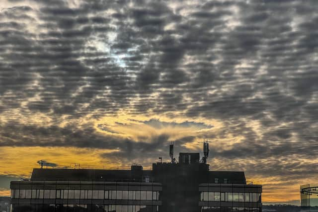
Nick Heppinstall captured the unusual sight – also known as a fallstreak hole – above the city last Tuesday, January 18, and says it was the first time he had seen anything like it while cloudgazing.
According to the Met Office, the eyecatching formation happens when part of the cloud layer forms ice crystals which are large enough to drop as a ‘fallstreak’.


Advertisement
Hide AdAdvertisement
Hide AdClouds of supercooled water droplets, which are below 0C but not yet frozen, need a tiny particle known as a nucleus to freeze or be cooled below -40C.
How can aircraft cause distinctive holepunch cloud formations?
Aircraft punching through this layer of cloud can cause air to expand and cool when passing over the wings or propeller, with the change in temperature enough to make the supercooled droplets freeze and fall in this distinctive pattern.
Have you seen anything like this before? Share your best weather photos with [email protected].