Storm Adrian and Hurricane Oscar set to bring heavy rain and strong winds to UK this weekend
and live on Freeview channel 276
Storm Adrian is arriving from the south east after battering Europe. It has killed at least 11 people in Italy, flooding much of Venice, and brought as much as 40cm of snowfall to south-central France.
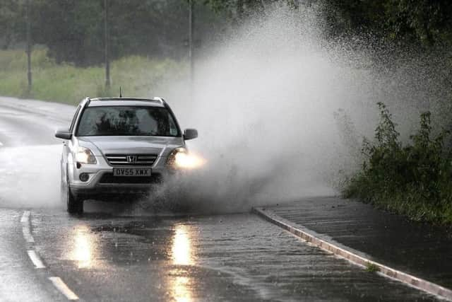
Its effects in the UK will be far less severe. It is set to bring wet, windy weather to the south east from Wednesday night, spreading to central and eastern England on Thursday.
Advertisement
Hide AdAdvertisement
Hide AdThe east and south east can expect as much as 15mm of rain and 45mph winds, before the weather settles on Friday, when most of the country is expected to be dry and sunny.

However, the respite will be brief. The tail end of Hurricane Oscar is likely to strike the UK over the weekend, with long rainy periods and even snow possible in some parts of the country.
A Met Office spokesman said: “The remnants of Hurricane Oscar will move into the eastern Atlantic and most likely track to the north west of the UK this weekend.
“This could bring strong winds and heavy rain, mainly to western and north western parts of the UK.
Advertisement
Hide AdAdvertisement
Hide Ad"However, there is currently some uncertainty in the exact track of Oscar, which would affect the detail of rainfall amounts and winds strengths, so it is too early for specific details at this stage.”
On the outlook for the weekend and beginning of next week, they added: “The weather will be generally unsettled through this period.
There will be some clear and sunny interludes, but interspersed with showers and longer spells of rain too.
“The heaviest rain is more likely in the west, whereas eastern parts of the UK are expected to be a little drier. It is likely to be fairly cold in the north west, with perhaps some sleet or snow at times on northern hills, but it will probably be slightly milder in the south east.
Advertisement
Hide AdAdvertisement
Hide Ad“However, overnight frosts are likely across the UK when the clear and dry interludes occur at night, perhaps with some frost and fog at times too. It will be windy at times with gales or perhaps severe gales, most likely around western coasts.”
Rain and wind could affect firework displays Gusts of 60mph are possible over the weekend, with as much as 60mm of rain predicted in the north west.
A possible side effect of the bad weather is the cancellation of Bonfire Night celebrations and firework displays.
But the good news is temperatures are set to increase slightly.
Advertisement
Hide AdAdvertisement
Hide AdEngland and Wales will be between 8-11ºC for the rest of the week, before rising to 12-14ºC over the weekend. Scotland and Northern Ireland will start out colder, between 6-8ºC, before reaching similar temperatures to the rest of the country on Saturday and Sunday.
The forecast for Yorkshire from the Met Office
Today:
Chilly start with a frost in places and rather cloudy, especially across western areas, with possible morning showers, mainly affecting the Dales. Dry and bright with sunny spells further east. Feeling a little milder by afternoon. Maximum temperature 10 °C.
Tonight:
Cloudy with showers or longer spells of rain later in the night. Turning quite murky with hills shrouded in cloud. Less cold than last night, with most places frost free. Minimum temperature 3 °C.
Thursday:
Early cloud and rain slowly clearing eastwards, most parts dry by early afternoon with some sunny periods developing. Cold Thursday night with a widespread frost. Maximum temperature 10 °C.
Outlook for Friday to Sunday:
Friday will be fine with plenty of sunshine. Clouding over later with overnight rain and strong winds continuing through Saturday morning before clearing to isolated showers. Rain later on Sunday.