Sheffield weather: This is when a Met Office warning for thundery showers and possible flooding will come into force
and live on Freeview channel 276
A yellow warning has been put in place for Sheffield, as well as some other areas in Yorkshire and the Humber, from midnight on Saturday, July 24 until 11.59pm on Sunday, July 25.
The Met Office says heavy rain and thundery showers may lead to flooding and transport disruption in some places.
Advertisement
Hide AdAdvertisement
Hide AdA further forecast says: “Outbreaks of rain and some thunderstorms are expected to spread from the southwest on Friday night, this introducing unsettled conditions to much of England and Wales for Saturday and Sunday.
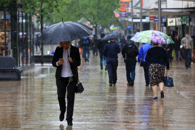

"Heavy, thundery showers are likely to break out by day, particularly on Sunday when these could be widespread and locally torrential. Lightning and hail are also expected. Rainfall amounts will vary from place to place, but there is the potential for up to 100 mm to build up in some locations over the course of the weekend, much of which could fall in a short period of time.”

What to expect
There is a small chance that homes and businesses could be flooded, causing damage to some buildings.
Where flooding occurs, there is a slight chance of delays or cancellations to train and bus services.
Advertisement
Hide AdAdvertisement
Hide AdSpray and flooding could lead to difficult driving conditions and some road closures.
There is a small chance that some communities will become cut off by flooded roads.
There is a slight chance of power cuts and loss of other services to some homes and businesses.
Tramlines Festival is also heading to the city this weekend, unfortunately coinciding with the more unsettled weather.
Advertisement
Hide AdAdvertisement
Hide AdAlthough temperatures may remain relatively high, they will be significantly cooler than they have been over the last week and Sunday will usher in a 70% chance of heavy rain…. which may not be what you were hoping for if you’re heading to Tramlines!
Here’s the latest forecast for the weekend
Friday, July 23: Overcast changing to sunny intervals in the afternoon. Highs of 23C in the afternoon and 16C in the evening, with between a five and ten per cent chance of rain. Medium pollen count.
Saturday, July 24: Yellow weather warning for rain. Highs of 19C in the afternoon and 16C in the evening, with a 40-50 per cent chance of rain in the afternoon and 10 per cent chance in the evening. Medium pollen count.
Sunday, July 25: Yellow weather warning for rain. Highs of 21C in the afternoon and 18C in the evening, with a 40-60 per cent chance of heavy rain in the late afternoon and 70 per cent chance of heavy rain in the evening.
Advertisement
Hide AdAdvertisement
Hide AdAccording to the Met Office, the weekend will look something like this: “Friday a little cooler, with sunny spells developing away from the coast. Saturday cooler and cloudier with some thundery rain later, then sunny intervals and some heavy showers on Sunday.”
People are being urged to take extra care when driving or travelling in the conditions and to look out for any localised flooding.