Sheffield weather: Hour-by-hour weather forecast for the weekend as yellow warning is issued for snow and ice
and live on Freeview channel 276
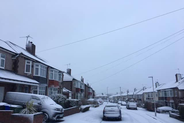
A thin covering of snow can be seen for most across Sheffield today after wintry showers this morning.
The Met Office has issued a yellow weather warning for the city with frequent sleet, hail and snow showers possibly leading to some disruption.
Advertisement
Hide AdAdvertisement
Hide AdClear conditions are expected tonight, with a widespread frost developing and a risk of ice on untreated surfaces. A band of rain or sleet will sweep through in the latter half of the night, with snow also possible, but this will likely be on higher ground. The minimum temperature will be around 3 °C.

Forecasters are predicting a dull and very wet day on Saturday, with heavy rain during the morning and afternoon. Then broken clouds and scattered wintry showers will follow.
Sunday will be a little breezy but much drier with a chance of a few showers, turning wintry with hail/sleet over high ground. It will be cloudy for most, with a few bright spells at times.
Monday will be cloudy, with patchy light rain or drizzle. It will be noticeably milder, with a maximum temperature of 8 °C.
MORE NEWS: Popular Sheffield city centre pub the Yorkshireman's Arms to be demolished over structural concerns
Advertisement
Hide AdAdvertisement
Hide AdIn their long-range forecast for next week, The Met Office is predicting milder temperatures and mainly settled conditions.
They say: “Cloudy with some light rain or drizzle and light winds in the south on Tuesday, but clearer conditions and sunny spells spreading to most, if not all, areas through the day.
“From Wednesday, high pressure is expected to build in the south, bringing settled conditions and mostly light winds. Temperatures will trend near average to mild, although there is still a risk of some overnight frost and fog.
“The north is likely to continue to see spells of cloud and rain, with some stronger winds. Confidence decreases through the period, but a return to generally more unsettled conditions across the UK is likely later on, with western and northwestern parts expected to continue to see the wettest and windiest weather. Temperatures likely to remain around average.”
Hour-by-hour forecast for Saturday:
5 am – Light rain (50% chance)
6 am – Light rain (50% chance)
7 am – Light rain (60% chance)
8 am – Heavy rain (80% chance)
9 am – Heavy rain (90% chance)
10 am – Heavy rain (80% chance)
11 am – Heavy rain (90% chance)
12 pm – Heavy rain (90% chance)
1 pm – Heavy rain (80% chance)
2 pm – Light rain (40% chance)
3 pm – Light rain (40% chance)
4 pm – Light rain (50% chance)
5 pm – Light shower (40% chance)
6 pm – Light shower (40% chance)
7 pm – Light shower (40% chance)
8 pm – Light shower (40% chance)
9 pm – Partly cloudy
10 pm – Cloudy
11 pm – Cloudy
12 am – Cloudy
Hour-by-hour forecast for Sunday:
6 am – Partly cloudy
9 am – Cloudy
12 pm – Cloudy
3 pm – Sunny intervals
6 pm – Cloudy
9 pm – Cloudy
12 am – Cloudy