
Neighbour in dark as land next to his house on busy Sheffield road taken out of Green Belt
A resident living along a busy Sheffield road has voiced concern over the lack of communication surrounding a plot of land next to his home that has recently been removed from the Green Belt.
As part of ongoing controversy around proposed housing and employment developments on greenfield sites across Sheffield, several parcels of land have been declassified from the Green Belt “to create a logical and defensible Green Belt boundary.”
One such piece of land lies between Chapeltown Road and Nether Lane. Although this particular site—separated from a designated housing area by a railway line—has not been earmarked for immediate development, it is no longer protected by Green Belt status, raising concerns about its future use.
Rob Fowler, a Cowley Lane resident, told the Local Democracy Reporting Service (LDRS) he only found out about the change through a local councillor, not through any official communication.
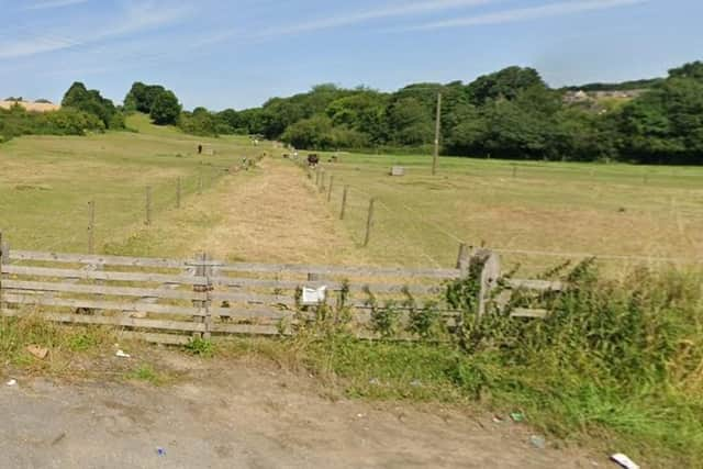

He said: “The consultation process will presumably finish before most people realise [what is happening]. It just feels like a bit sneaked through for the scale of it… There is nothing to indicate the scale, potentially, the changes that all come down the line.”
In Rob’s case, the land directly adjacent to his home—on the opposite side of the railway line—has been affected by the Green Belt change.
A council spokesperson stated that the report submitted to the Strategy & Resources Committee on April 30 “makes it clear that the allocation of some of the proposed additional sites will necessitate some further alterations to the Green Belt boundary in order to satisfy the national requirements to create a logical and defensible Green Belt boundary.”
However, Cllr Mike Levery, who represents the West Ecclesfield ward, argued that the railway line separating the land parcels should serve as a natural boundary.
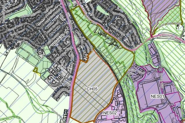
He questioned the necessity of further Green Belt deletion, noting that part of the land may not have been allocated for development due to “ownership issue,” which could explain why only one side of the railway has been designated for housing in the report.
But what happens if the unallocated land is sold?
“Then that’s it, once it’s deleted from the Green Belt, that’s gone,” he added.
Rob, who attended council meetings and reviewed the reports, said he found little indication or emphasis on the land near his home.
“It’s a bit sneaky,” he said.
He felt overwhelmed by the volume and complexity of the information in the reports: “It’s almost like they’ve gone ‘right, let’s just throw a lot of stuff to the people and there’d be too much for them to process.’”
He also criticised the reports for being filled with repetitive content and insider jargon that wasn’t accessible to the general public. Rob admitted he didn’t fully understand what the deletion of Green Belt status meant or what might be planned for the land next door.
There has been speculation that the land could be designated for employment use in the future, potentially becoming an extension of an existing site across the road.
Rob said he was left with many unanswered questions: what kind of development would be proposed, how much traffic would it bring, and how it would affect daily life?
“We’re already clocked up on both of these roads, twice a day they become standing traffic only,” he said.
Rob acknowledged the need for new housing and said he was open to development—even near his home—but stressed the need for transparency and greater public engagement.
He said: “I could be convinced about parts of it… Now, unless the plan is to just throw lots at the wall and hope some of it sticks…”
Cllr Levery reiterated his concern that once land is removed from the Green Belt, it opens the door for planning applications under the standard process for employment land.
“In fact, you can build on this before you can get the houses up,” he added.
As previously reported by the LDRS, a review of the documents published in advance of the council’s Strategy and Resources Committee and Full Council meetings reveals a detail that has not been publicly discussed: Appendix 2 indicates that nine of the proposed sites include further areas earmarked for “Green Belt deletion.”
The sites in question where there is additional “Green Belt deletion” on top of the proposed green belt release:
Site Reference: NWS30 on Land at Forge Lane, S35 0GG
Site Reference: NWS31 on Land between Storth Lane and School Lane, S35 0DT
Site Reference: NES37 and NES39 on Land between Creswick Avenue and Yew Lane, S35 8QN
Site Reference: NES38 on Holme Lane Farm and land to the west of Grenoside Grange, Fox Hill Road, S35 8QS
Site Reference: SES29 on Handsworth Hall Farm, Land at Finchwell Road, S13 9AS
Site Reference: SES30 on Land between Bramley Lane and Beaver Hill Road, S13 7JH
Site Reference: SS19 on Land to the south of White Lane, S12 3HS
Site Reference: CH04 at Hesley Wood, north of Cowley Hill, S35 2YH
Site Reference: CH05 on Land to the east of Chapeltown Road, S35 9ZX
The council also stated: “In most cases, any additional land that is removed is proposed to be designated as an Urban Green Space Zone.”
The council emphasised that out of Sheffield’s 9,061 hectares of green belt, 327.45 hectares (3.6%) would be removed. Of that, 234.42 hectares (2.6%) is allocated for development, including 180.76 hectares for housing and employment.
Following the currently ongoing public consultation between May 29 and July 11, another round of public consultation would take place in early 2026 before the inspectors issue their final report.
Finally, the council would meet to decide whether to adopt the revised plan, which is expected to be in force by July 2026.