Mystery of plane spotted circling over Sheffield is solved
and live on Freeview channel 276
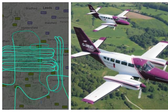
The purple and white aircraft was spotted flying back and forth across the Peak District between Sheffield and Stockport last Wednesday, March 17, into Thursday morning.
According to the FlightRadar24 tracking website, it left East Midlands Airport at 8.47pm and was in the air for nearly five hours, until 1.39am.

Advertisement
Hide AdAdvertisement
Hide AdThe Environment Agency has now confirmed that the plane, a Reims-Cessna F406 Caravan II with the registration G-LEAF, is one of its aircraft.
A spokeswoman for the organisation said: “The aeroplane seen flying over Sheffield, Stockport, Chesterfield and Barnsley during the early hours of Thursday morning was one of the Environment Agency’s survey aircraft.
“The flight was capturing LIDAR data, which stands for Light Detection and Ranging, and uses a laser to capture a very accurate model of the earth’s surface. This information is used to help us model flood risk, helping better protect local communities.
“This method of data capture is heavily dependent on good weather conditions (it cannot operate if there is cloud cover), which is why these aircraft operate at any time of day, often at night.”
Advertisement
Hide AdAdvertisement
Hide AdThe Environment Agency has previously described how it operates two light aircraft from East Midlands Airport.
It said its small team of aerial surveyors spend on average more than 1,000 hours a year in the air capturing high resolution digital photography and LIDAR (Light Detection & Ranging) data around the country and last year surveyed more than 15,000 sqkm sof England’s urban areas, coastal zones and rural river plains.