Heatwave: This is how long the warm weather will continue for in Sheffield
and live on Freeview channel 276
The past few weeks of warm and sunny weather in Sheffield has seen many people heading to their local parks, having barbeques and getting their paddling pools out, but this sunshine could be coming to a halt as colder spells are expected over the coming days.
Temperatures are expected to reach as high as 23°C across the city today with sunny weather and a gentle breeze.
Advertisement
Hide AdAdvertisement
Hide AdBut today could be the last day of the heatwave as temperatures are expected to plummet on Wednesday with highs of 13°C and light rain.
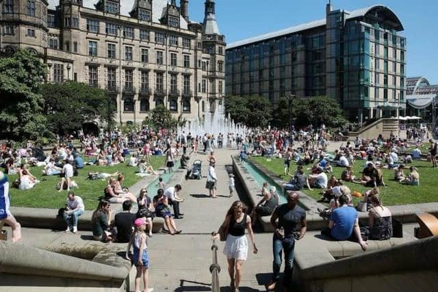

After weeks of warm weather, how long this colder spell last is the question on everyone’s lips.
☀️With 266 hours of bright sunshine, May 2020 is now officially the sunniest month on record for the UK☀️☀️Spring 2020 is also the sunniest on record for the UK exceeding the sunshine amount for most summer seasons☀️Our press release has more👉 https://t.co/2yQjD875hM pic.twitter.com/pijhJHr7AA
— Met Office (@metoffice) June 1, 2020
The good news is that there will be long periods of uninterrupted sunshine and temperatures measuring 23°C on Tuesday with lows of just 12°C.
Advertisement
Hide AdAdvertisement
Hide AdBut the Met Office forecasts rain for tomorrow through to Saturday with scattered showers and the odd bright spell - with temperatures across the region expected to plummet from a delightful 23°C in the day to a lacklustre 7°C at night.
Tuesday
A dry day with plenty of sunshine and light winds once any early early fog patches clear. It will feel very warm in the sunshine. Maximum temperature 23 °C.
Wednesday to Saturday
There will be rain first thing on Wednesday that will move eastwards through the day. It will feel colder than recent days with the maximum temperature reaching 12°C.
This new period looks to be a lot cooler than the past few weeks with more cloud cover.
Advertisement
Hide AdAdvertisement
Hide AdOver the next few days, we should expect light rain and scattered showers alongside sunny or bright spells.
It is expected to be breezier on Saturday with sunny intervals becoming cloudy through the mid morning and temperatures as low as 8°C – making it feel cool.
Sunny spells and showers are likely across Sunday too, with highs of 13°C and getting as chilly as 8°C in the evening.
Social distancing guidelines
People are currently allowed to meet up to six people outside, as look as you maintain social distancing rules by keeping at least two metres apart and keeping up consistent hand and respiratory hygiene practices.
Advertisement
Hide AdAdvertisement
Hide AdThose aged over 70 are considered to be at high risk of contracting the virus and more vulnerable, so should be extremely careful in following social distancing measures and maintaining hand hygiene.
Guidance for people who are shielding
If you have received a letter advising you to shield for 12 weeks, it’s because you could be at higher risk of catching coronavirus and the advice for you to shield remains in place.
You should still not go outside even if you maintain a safe two metre social distance.
This advice is there to protect you and keep you safe and while it can be challenging, these restrictions will not last forever.
The guidance will be updated before the 12 weeks is up and you will be informed about what the new measures mean for you.