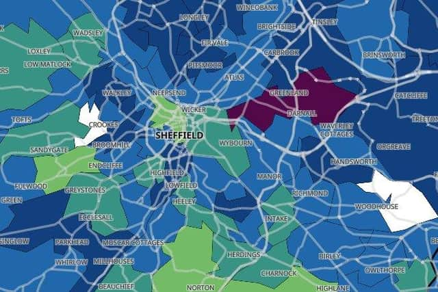
Coronavirus map shows TWO areas of Sheffield that are now almost Covid-19 free
and live on Freeview channel 276
An interactive map showing the number of confirmed positive cases in each area, based on Government data, reveals there were fewer than three cases in Crookes and Woodhouse Mill in the seven days to December 3.
The exact number of positive cases there is not known because data is not given for areas with three or fewer cases to protect individuals' identities.
Advertisement
Hide AdAdvertisement
Hide Ad25 other areas of Sheffield – Norton and Norton Lees, Mosborough and Halfway, Westfield and Waterthorpe, Woodhouse West, Intake, Charnock and Base Green, Herdings and Gleadless Valley, Beauchief, Batemoor and Jordanthorpe, Fulwood and Lodge Moor, Sharrow, Brincliffe, Ecclesall and Greystones, Hackenthorpe, Endcliffe and Ranmoor, Sandygate and Crosspool, Lower Stannington, Upper Stannington and Loxley, Wadsley and Marcliffe, Hillsborough, Ecclesfield South, Cathedral and Kelham, Park Hill and Wybourn, Heeley and Newfield Green and Shiregeen South – recorded ten or fewer new cases.


The latest available data shows that the infection rate in Sheffield continues to fall.
For the week leading up to December 3 the rate was 147.6 per 100,000 people. This means there were 863 new cases confirmed in that week.
Data for the most recent four days (December 4-7) has been excluded as it is incomplete and does not reflect the true number of cases.
Advertisement
Hide AdAdvertisement
Hide AdIn the week before, the infection rate in Sheffield was 181.8, reflecting 1,063 new cases confirmed that week.
The city has been placed under Tier 3 restrictions until at least December 16, when the Government will review progress made in slowing the spread of the virus.